CampbellReith utilise Geographical Information Systems (GIS) across the practice on a wide range of projects and disciplines to produce a variety of outputs and analysis. One of the tools used by our GIS team is the GIS Site Model (GISSMo), which is an internet-based GIS, which functions as an interactive geographically searchable database. It can host thousands of datasets and documents based on their coordinates, feature locations and attributes that are displayed on a map, which the user can interrogate to find the information they require.
For Kilnwood Vale, a 132ha site near Crawley with a 42ha former landfill, a bespoke GISSMo was created, that is used to host reports, figures and other important datasets for the project in a central database.
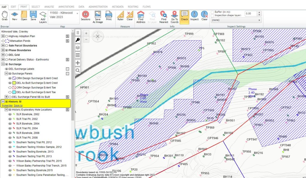 GI + Surcharge Panels
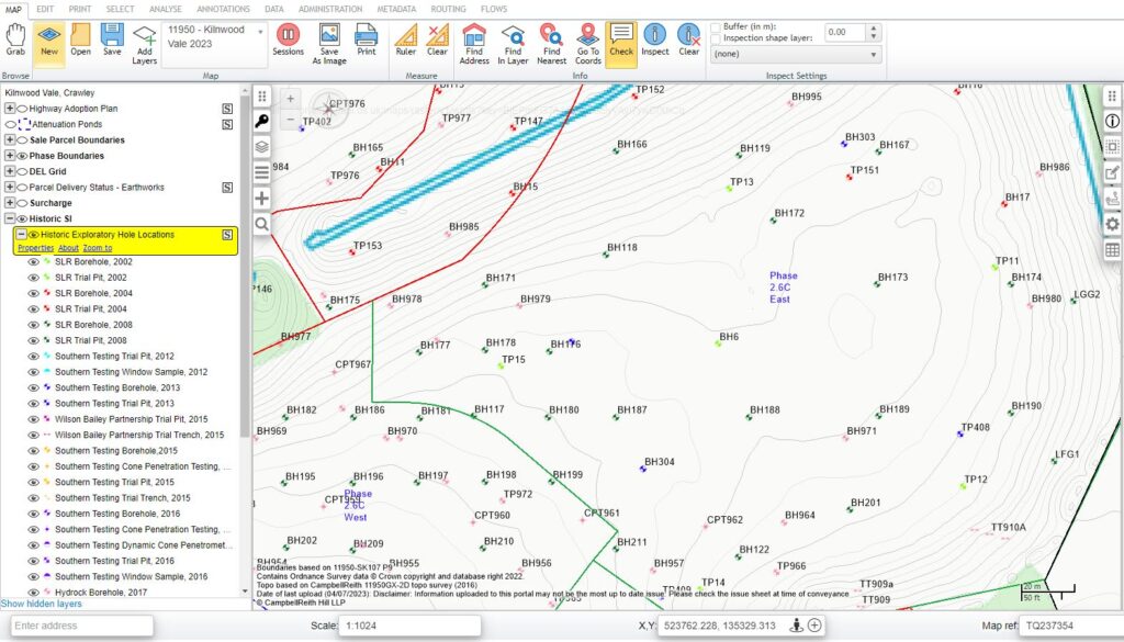 GI Labels
One of the main requirements of the GISSMo, was to provide quick and easy access to key reports, earthworks figures and documentation associated with the project, such as the verification reports, gas validation reports and remediation strategies for the team and the client. This was achieved by collating all the relevant reports from CampbellReith and the contractor onto our online file hosting database and assigning them to the relevant phases of the project. The user could then click on the phase of interest on site to obtain the list of available reports and download them using the associated hyperlink.
GISSMo was also used to display the numerous GIS datasets used on the project, so that they could be viewed by the team and the client. The datasets included the design and as built extents of the surcharge panels employed to induce settlement, highway adoption plan and the ground investigation locations with detail on the depths of Made Ground across site. Once imported, the data could easily be hidden/made visible and overlain on top of other data in the map space, allowing for quick checks to be made on the data as well as any interactions between data, where it could usually involve lengthy checks through reports to compare.
The use of GISSMo has been particularly helpful in increasing efficiency for certain elements of the project. Where previously email requests for different documents or details on datasets would be common, they can now easily be checked by quickly logging into the GISSMo and interrogating the database for all the uploaded information. This improvement in communication is vital to reducing the risk on the project, by ensuring that all data and reports available are current and correct. This also applies to the visual element of the GISSMo database, which provides clarity on the extent of the remedial works and their current status to the client and other staff that work on the project.
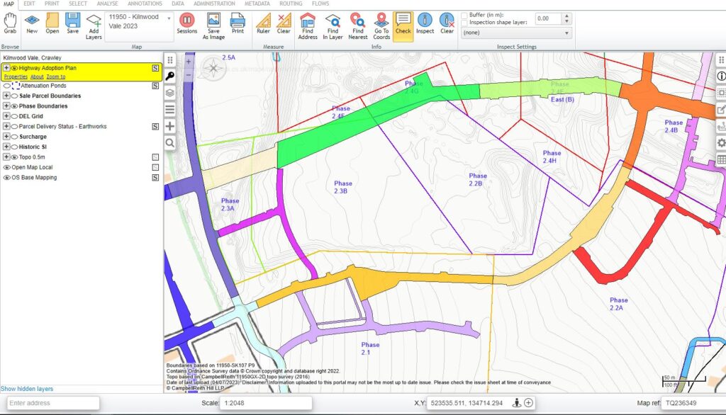 Road Plans
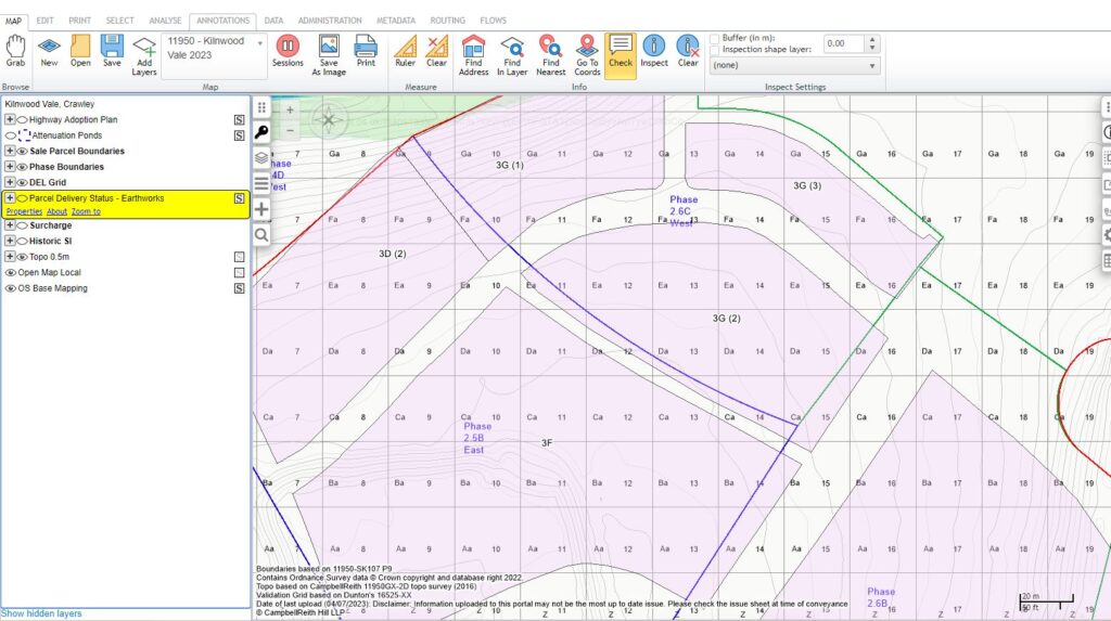 Sale Parcels + DEL Grid
The GISSMo has been a key factor in the success of the project and has been greatly utilised by all staff working on the project. From our Land Quality team, where identifying depths of residual Made Ground is essential to ground gas risk, to the Geotechnical team identifying how the surcharge panels have been constructed on site compared to the design extents and for the Civils team, who are able to view how the proposed infrastructure will interact with the site features. These successes, among many others have resulted in Kilnwood Vale recently being shortlisted for the Best Sustainable Brownfield Regeneration Project in the upcoming Brownfield Awards.
If you would like to know more about our GIS and digital services, please get in touch with Rhys Francis.